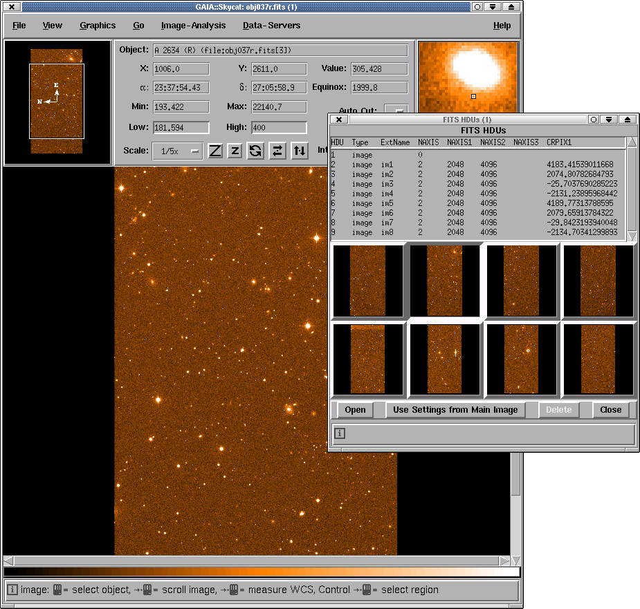
Displaying FITS MEF files
This image shows the latest version of GAIA displaying a Multiple
Extension Fits file (MEF). The image is from the KPNO CCD Mosaic
camera. Using this new facility allows you to trivially see each
extension image and display it (the second extension image is shown
displayed here). It is also possible to perform analyses, without
extracting the images from the extensions.
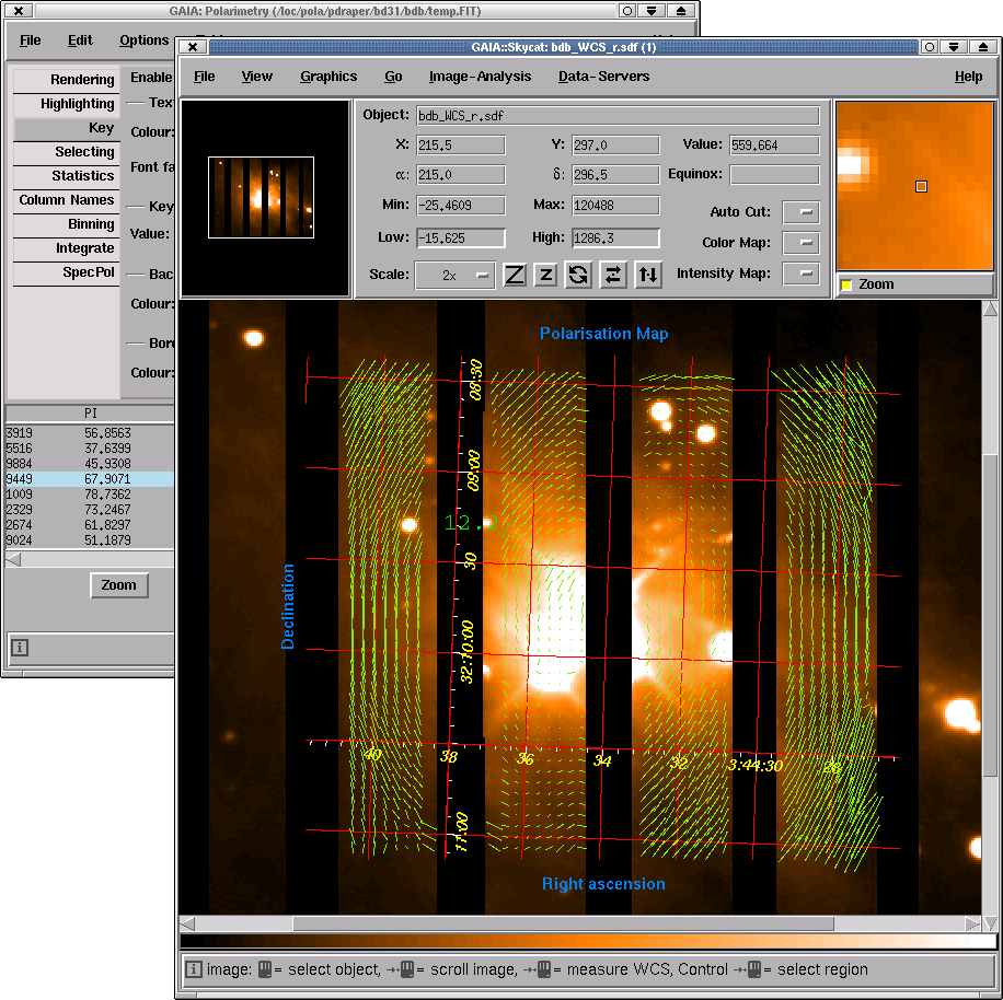
Displaying polarization data
In this picture GAIA is shown displaying a linear polarization map as
a series of green vectors. The object is a bright star with
surrounding nebulosity. The star is clearly the main source of
scattered light in the region, as can be seen by the pattern of
vectors that form a centro-symmetric pattern about it.
This new facility is provided by the Polarimetry toolbox. This is
designed to most closely work with catalogues produced by the POLPACK
package, but will accept polarization data from other sources.
The toolbox allows you to interact with the vector map, by providing a
continuous reading out of individual values and by selecting sub-sets
of vectors. Subsets can be defined using algebraic expressions or by
dragged out rectangular regions. Any selected parts can be removed or
saved to new catalogues. New vector maps can be created by binning
vectors and simple statistical properties of the selections can be
reported.

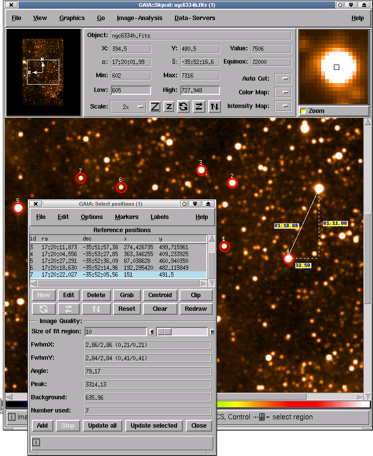
Recording positions
This image shows another of GAIA's new toolboxes in action. This one
is designed to help you record the positions of any interesting
features (say an observing list) and to measure the integrated seeing
properties of the objects.
The list of positions can be saved to a simple text file, and may also
be restored from such a file, so you can create lists of potentially
interesting objects easily from other sources.
Other interesting features are the ability to precess any input
positions to the coordinate system of the image and to do things like
show labels for all or some of the objects, as well as the usual list
of facilities for determining the marker colours, centroiding to the
nearest intensity peak etc.

|